Residents asked to improve Murrindindi’s flood mapping
Published on 16 October 2026
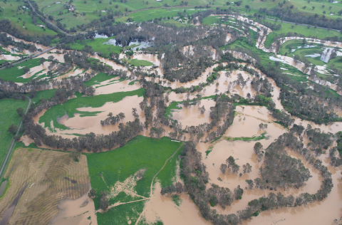
Murrindindi Shire Council is calling on residents to share their flood experiences and local knowledge to help improve flood mapping and planning across three key catchments.
Floods leave their mark in different ways. For some, it may be a home that has flooded, or a road that regularly goes underwater. For others, it may be a paddock inundated after heavy rain, rising water around a property, or knowledge of how previous floods have moved through the local area.
Technical modelling and mapping are important tools for understanding flood risk and identifying areas likely to be affected. Local knowledge adds another important layer, helping to test and refine the modelling against what people have actually seen and experienced on the ground.
Council, in conjunction with Goulburn Broken Catchment Management Authority (GBCMA) and specialist consultants is undertaking flood studies across the Mid Goulburn, Yea River and King Parrot Creek catchments. The studies will improve understanding of flood behaviour, support emergency planning and help identify opportunities to strengthen community resilience.
Murrindindi Shire Sustainability and Assets Portfolio Councillor Paul Hildebrand said community experiences would play a vital role in ensuring the studies reflect the realities of flooding across the shire.
“People who live and work in these catchments have valuable knowledge that can't be captured through maps and modelling alone,” Cr Hildebrand said.
“They know which roads go under, which parts of their properties get inundated, where water tends to sit or flow, and how past flood events have affected their properties and communities.”
“That's the sort of information that can make a real difference. If you've got local knowledge or experience of flooding, we want to hear from you. The more local knowledge we get, the better informed these studies will be and the better prepared our communities will be for the future.”
Council is encouraging residents to share their experiences, contribute information through an interactive map, attend a community information session or express interest in joining a Flood Study Community Reference Group.
The studies cover the Mid Goulburn area around Molesworth and Thornton, the Yea River catchment including Yea and Glenburn, and the King Parrot Creek catchment including Flowerdale and Strath Creek.
Community information sessions are being held throughout October, giving residents an opportunity to meet the project team and consultants, view flood maps, ask questions and share their local knowledge and experiences.
Feedback closes on 1 November 2026.
To learn more, share your feedback or view upcoming community information session dates, visit murrindindi.vic.gov.au/floodstudy